Earthquakes / EVENT RECORD
M 5.6 - 74 km S of Yonakuni, Japan
USGS · Every measurement below belongs to the selected record.
Around the epicentre
Regional view · markers are locations, not affected areas
Magnitude
M 5.6
Scale: mww
Depth
10.792 km
from location
Reported by people
11
Number of felt reports
USGS review
reviewed
Review does not imply final measurements
What the record tells us
USGS reports a magnitude 5.6 earthquake in 74 km S of Yonakuni, Japan, at a depth of 10.792 km.
Detailed source data captured 2026-09-30 22:14:41 UTC.
Measurements & confidence
- Event time (UTC)
- 2026-09-30 05:00:24.971 UTC
- Source updated (UTC)
- 2026-09-30 17:22:25.040 UTC
- Location
- 23.803°, 122.915°
- Stations used for location
- 94
- Horizontal error
- 4.11 km
- Depth error
- 4.148 km
- Magnitude error
- 0.062
Errors are the source’s reported uncertainty estimates, not guaranteed bounds. A depth marked “operator assigned” was fixed during analysis.
Shaking & impact
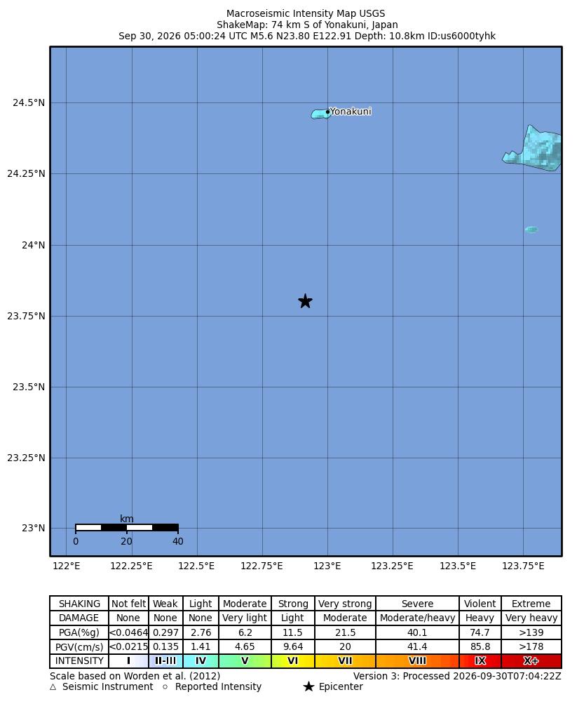
- Instrumental intensity
- 3.747 MMI
- Felt-report intensity
- 4.1 CDI
- PAGER impact alert
- green
No published assessment does not mean no shaking or no impact. A magnitude value alone cannot establish damage or a tsunami warning.
Nearby seismic activity
Within 500 km · M2.5+ · seven days before the event through the latest query, up to seven days after
09-23
0
09-24
0
09-25
0
09-26
0
09-27
0
09-28
1
09-29
0
09-30
0
Query window: 2026-09-23 05:00:24 to 2026-09-30 22:14:41 UTC. This is spatial proximity, not an identified aftershock sequence.
View the USGS catalogue query ↗Magnitude
M 5.6
Scale: mww
Depth
10.792 km
from location
Reported by people
11
Number of felt reports
USGS review
reviewed
Review does not imply final measurements
What the record tells us
USGS reports a magnitude 5.6 earthquake in 74 km S of Yonakuni, Japan, at a depth of 10.792 km.
Detailed source data captured 2026-09-30 22:14:41 UTC.
Measurements & confidence
- Event time (UTC)
- 2026-09-30 05:00:24.971 UTC
- Source updated (UTC)
- 2026-09-30 17:22:25.040 UTC
- Location
- 23.803°, 122.915°
- Stations used for location
- 94
- Horizontal error
- 4.11 km
- Depth error
- 4.148 km
- Magnitude error
- 0.062
Errors are the source’s reported uncertainty estimates, not guaranteed bounds. A depth marked “operator assigned” was fixed during analysis.
Shaking & impact
- Instrumental intensity
- 3.747 MMI
- Felt-report intensity
- 4.1 CDI
- PAGER impact alert
- green
No published assessment does not mean no shaking or no impact. A magnitude value alone cannot establish damage or a tsunami warning.
Nearby seismic activity
Within 500 km · M2.5+ · seven days before the event through the latest query, up to seven days after
09-23
0
09-24
0
09-25
0
09-26
0
09-27
0
09-28
1
09-29
0
09-30
0
Query window: 2026-09-23 05:00:24 to 2026-09-30 22:14:41 UTC. This is spatial proximity, not an identified aftershock sequence.
View the USGS catalogue query ↗The record as it develops
This timeline begins when our journal started capturing details. It is not a complete USGS revision history.
Captured 2026-09-30 05:22:14 UTC
First detailed capture · M5.6 · 10.792 km deep · 1 nearby records
Source updated 2026-09-30 05:22:01 UTC
Captured 2026-09-30 05:37:14 UTC
Updated capture · M5.6 · 10.792 km deep · 1 nearby records
Source updated 2026-09-30 05:32:08 UTC
Captured 2026-09-30 05:52:14 UTC
Updated capture · M5.6 · 10.792 km deep · 1 nearby records
Source updated 2026-09-30 05:39:36 UTC
Captured 2026-09-30 06:37:14 UTC
Updated capture · M5.6 · 10.792 km deep · 1 nearby records
Source updated 2026-09-30 06:33:11 UTC
Captured 2026-09-30 06:52:14 UTC
Updated capture · M5.6 · 10.792 km deep · 1 nearby records
Source updated 2026-09-30 06:46:07 UTC
Captured 2026-09-30 07:07:14 UTC
Updated capture · M5.6 · 10.792 km deep · 1 nearby records
Source updated 2026-09-30 07:05:15 UTC
Captured 2026-09-30 07:22:14 UTC
Updated capture · M5.6 · 10.792 km deep · 1 nearby records
Source updated 2026-09-30 07:07:23 UTC
Captured 2026-09-30 07:37:14 UTC
Updated capture · M5.6 · 10.792 km deep · 1 nearby records
Source updated 2026-09-30 07:27:13 UTC
Captured 2026-09-30 08:41:57 UTC
Updated capture · M5.6 · 10.792 km deep · 1 nearby records
Source updated 2026-09-30 08:39:17 UTC
Captured 2026-09-30 09:41:57 UTC
Updated capture · M5.6 · 10.792 km deep · 1 nearby records
Source updated 2026-09-30 08:39:17 UTC
Captured 2026-09-30 10:41:58 UTC
Updated capture · M5.6 · 10.792 km deep · 1 nearby records
Source updated 2026-09-30 08:39:17 UTC
Captured 2026-09-30 11:41:59 UTC
Updated capture · M5.6 · 10.792 km deep · 1 nearby records
Source updated 2026-09-30 08:39:17 UTC
Captured 2026-09-30 12:56:57 UTC
Updated capture · M5.6 · 10.792 km deep · 1 nearby records
Source updated 2026-09-30 08:39:17 UTC
Captured 2026-09-30 14:14:40 UTC
Updated capture · M5.6 · 10.792 km deep · 1 nearby records
Source updated 2026-09-30 08:39:17 UTC
Captured 2026-09-30 15:14:47 UTC
Updated capture · M5.6 · 10.792 km deep · 1 nearby records
Source updated 2026-09-30 08:39:17 UTC
Captured 2026-09-30 16:29:40 UTC
Updated capture · M5.6 · 10.792 km deep · 1 nearby records
Source updated 2026-09-30 08:39:17 UTC
Captured 2026-09-30 17:29:41 UTC
Updated capture · M5.6 · 10.792 km deep · 1 nearby records
Source updated 2026-09-30 17:22:25 UTC
Captured 2026-09-30 18:44:40 UTC
Updated capture · M5.6 · 10.792 km deep · 1 nearby records
Source updated 2026-09-30 17:22:25 UTC
Captured 2026-09-30 19:44:42 UTC
Updated capture · M5.6 · 10.792 km deep · 1 nearby records
Source updated 2026-09-30 17:22:25 UTC
Captured 2026-09-30 20:59:42 UTC
Updated capture · M5.6 · 10.792 km deep · 1 nearby records
Source updated 2026-09-30 17:22:25 UTC
Captured 2026-09-30 22:14:41 UTC
Updated capture · M5.6 · 10.792 km deep · 1 nearby records
Source updated 2026-09-30 17:22:25 UTC
Magnitude is not shaking
Magnitude describes the earthquake’s size. The shaking experienced at a place depends on distance, depth, local ground conditions and the rupture.
Depth needs context
A reported depth describes the location of the earthquake underground. Some solutions use an assigned depth; uncertainty and review status matter.
Nearby does not mean aftershock
Our regional search finds events by distance and time. Establishing an aftershock sequence requires seismological assessment.
This is a source-linked archive. Source measurements and assessments can change. An archived bulletin is not evidence that a warning is currently active.
In the daily journal
30 September 2026 ↗SOURCE ID usgs:us6000tyhk